

The National Weather Service said that moisture from Tropical Storm Imelda will spread mainly light to moderate rain north into the Carolinas through tonight, with some patchy light rain possibly continuing through the first half of Tuesday as Imelda begins to turn east and out to sea.
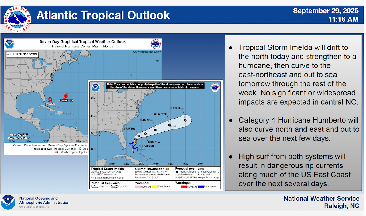
Imelda is expected to drift to the north today and strengthen to a hurricane, then curve to the east-northeast and out to sea tomorrow through the rest of the week. No significant or widespread impacts are expected.
Meanwhile, the NWS said category 4 Hurricane Humberto will also curve north and east and out to sea over the next few days.
High surf from both systems will result in dangerous rip currents along much of the east coast over the next several days.
The NWS also reported that high pressure will bring drier air and clearing skies by Wednesday through at least Saturday, with maybe some patchy light rain in the southeast on Sunday.
After one warmer day on Wednesday, a taste of autumn will arrive on Thursday and Friday with highs in the upper-60s to mid-70s and lows in the upper-40s to mid-50s.
Highs will moderate to the mid-70s to 80 by Sunday.


