

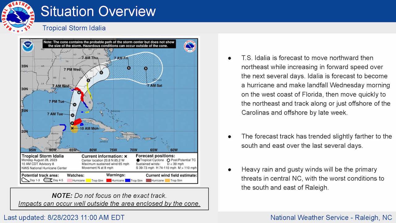
The National Weather Service said in its late morning briefing that Tropical Storm Idalia is expected to make landfall on the west coast of Florida and then move northeast over coastal Georgia and the coastal Carolinas Wednesday through Thursday night.
Impacts are expected across portions of central North Carolina by midweek.
The NWS Raleigh bureau said heavy rainfall and gusty winds will be the main threats — primarily south and east of Raleigh.


There is currently uncertainty about Idalia’s track and how far inland significant effects will spread.
Impacts include sustained winds of 15- to 25-miles per hour with gusts between 25- to 35-miles per hour. Isolated gusts of 40-miles per hour could be experienced in the far southeast part of the state,
As much as 1 to 5 inches of rain could fall south and east of Raleigh with the highest totals southeast of a line from Charlotte to Roanoke Rapids.
There is a tornado risk in the far southeastern portion of the state.


