

City Manager Joseph Scherer told Roanoke Rapids council Tuesday night all departments are making preparations for Hurricane Dorian damage response.
“As of now, the track of the storm indicates we could receive two to six inches of rain and sustained winds of 35 to 45 miles per hour,” he said in his report to the panel.
He said the city had a conference call with county emergency management Tuesday to coordinate efforts and identify resource shortfalls.
The Roanoke Rapids Theatre will be used as a staging area for power crews.
American Red Cross information has been placed on City Channel 193.
Hurricane preparedness tips have been posted to the city’s website and departmental social media pages.
At 7 a.m. Tuesday, the public works department opened a valve at Rochelle Pond and water is going down slowly, Scherer said. “Public works crews (are) riding streets, picking up grass and debris out of gutters (and) storm drains before (the) storm hits.”
The Roanoke Rapids Graded School District said on its Facebook page, “RRGSD leadership is working with local agencies to monitor the latest forecast. We will keep you updated regarding possible closure and potential cancelation of athletic events. In addition to posting on our social media, website, and mobile notifications, we will also send out an all call via phone and text.”
Scott Aman, president of New Dixie Oil Corporation said in a brief statement, “Please know that we — New Dixie leadership and all staff — are preparing, as we usually do, for major a storm-hurricane.”


In its 7 a.m. briefing today, the National Weather Service in Raleigh said a tropical storm watch was issued this morning shortly after 5:30.
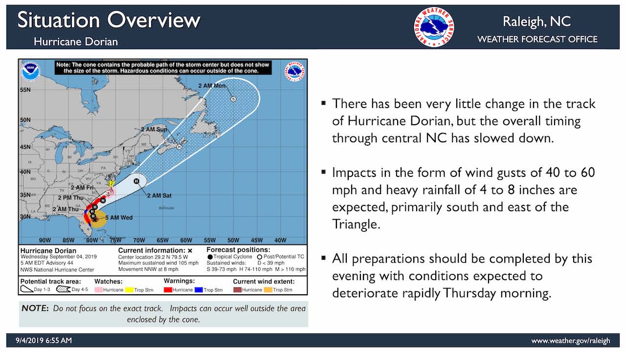
“There has been very little change in the track of Hurricane Dorian,” the NWS said, “But the overall timing through central North Carolina has slowed down.”
Impacts in the form of 40- to 60-mile per hour wind gusts and heavy rainfall — 4 to 8 inches — are expected primarily south and east of the Triangle.
The highest amounts of rainfall are expected along and east of Interstate 95 Thursday through midday Friday. The strongest winds are expected east of the Highway 1 corridor Thursday afternoon through Friday morning. “Confidence (is) increasing that impacts will be felt across central North Carolina, especially in areas along and east of (Highway 1).”
Tropical storm wind gusts are capable of blowing down trees, which may cause structural damage and power outages.
Hurricane-force winds, the NWS said, “are nearly certain to remain east of central North Carolina.”
The most likely time southern and eastern portions of the state could begin to see tropical storm winds is Thursday morning into the afternoon.
The greatest threat for flash flooding is along and east of I-95.


