

The National Weather Service said in its latest briefing today there remains the potential for tropical storm strength wind gusts from Hurricane Dorian.
The gusts are expected mainly east of the Highway 1 corridor and the timing of highest winds is expected Thursday afternoon and night.
The highest amounts of rainfall — between 2 to 6 inches — are expected from the Triangle south and east with lesser amounts west. Heavy rain could result in localized poor drainage and urban flooding with the highest amounts of rainfall east of Interstate 95 Thursday through Friday morning.
There is a low risk for isolated tornadoes east of Interstate 95, the NWS said.


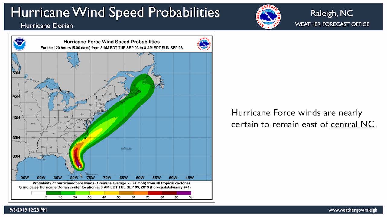
Confidence has increased impacts will be felt across portions of central North Carolina, especially in areas east of Highway 1.
The NWS says there is a five in 10 chance portions of central North Carolina will see tropical storm force winds, mainly south and east of Raleigh.
The winds are capable of blowing down trees, which could cause structural damage and power outages. The risk for damaging winds decreases from Raleigh westward.
In his report to commissioners today, Halifax County Manager Tony Brown said the county is monitoring the storm closely and was planning a conference call with the state at 12:30 this afternoon. Information from that call would be relayed to municipalities throughout the county, he said. “We do expect an impact Thursday in the Interstate 95 area.”
He said there is the possibility of 2 to 3 inches of rain, although that could change depending on the storm’s track. “It will probably be more of a wind event than a flooding event. Hopefully it will be around the fringes.”


