

The city of Roanoke Rapids has issued a state of emergency declaration in response to Tropical Storm Isaias.
The declaration comes with no curfew.
“City staff and emergency personnel are actively monitoring the storm and recognize that natural disaster response in the midst of the COVID-19 pandemic requires increased planning and preparation in order to protect public health and public safety of our citizens,” the city said in a statement. “If conditions worsen, Roanoke Rapids is prepared to quickly communicate with residents and respond to any storm related issues.”
The statement said Isaias is expected to strengthen into a hurricane before it makes landfall along the North Carolina-South Carolina coast around 9 this evening.
Halifax County is under a tropical storm warning as Isaias is projected to rapidly move north along the Interstate-95 corridor overnight. “According to the National Weather Service, our region may experience high winds, isolated tornadoes, heavy rains and flooding that may bring significant impacts to public and private property and may seriously disrupt essential utilities services and systems.”


The city encourages residents to be hurricane-safe and ready by:
Staying off roads during heavy rains and peak impact times
Securing garbage/recycling cans, lawn furniture, umbrellas, bicycles, grills, hanging plants and lawn decorations
Buying extra batteries for flashlights in case of power outages
Keeping your smartphone and weather radios charged, turned on and near you throughout the duration of Tropical Storm Isaias
Keeping out of standing water with vehicles as well as on foot
“The city of Roanoke Rapids urges our citizens to plan, prepare and stay informed throughout the duration of the storm.”
Visit www.readync.org for storm updates including evacuation orders, power outages, real time flood gauges, preparedness tips and more.
The city’s website and Facebook page will also have information.
Halifax County
Halifax County today also issued a state of emergency.
"At this time we do not plan to open any shelters. With the impacts of the storm to come primarily during overnight hours, those who live in flood prone areas that choose to evacuate are asked to stay with a family member, a friend, or in a hotel if possible," the county said. "Otherwise, all citizens are urged to stay home for the duration of the storm and have emergency supply kits nearby."
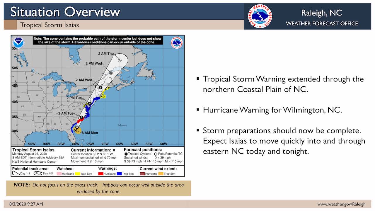
Meanwhile, in its 9:30 briefing this morning the National Weather Service in Raleigh reported the tropical storm warning has been extended northeast to include the northern Coastal Plain while hurricane warnings have been issued for the state's coast.
The NWS said the latest models have trended faster with the northeast progression of the storm across central North Carolina through tonight.
There is the potential for damaging winds mainly along and east of Interstate 95 this evening through Tuesday morning.
Two to 4 inches of rain is possible across central North Carolina which could lead to localized flooding.
There is a threat of isolated tornadoes mainly along and east of I-95.
Tropical force winds, mainly in the form of gusts, will result in tree damage and subsequent power outages in areas along and east of the interstate where the highest wind gusts are expected.
The most likely time for the arrival of tropical force winds in central North Carolina is this evening or tonight.


